City Maps
Berlin | Road
Maps | Districts | City
Center | Mitte | Public
Transport | Historical
 Transportation
Systems Transportation
Systems
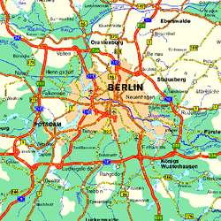
Berlin is surrounded by an Autobahn ring which is linked together
to other autobahns heading in all directions of the compass.
Click on the map to receive a
larger view.
Return to top
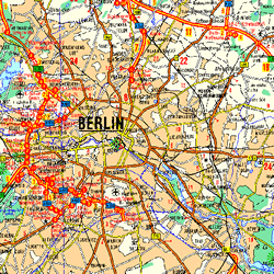 Berliner
Stadtautobahn (City Autobahn) Berliner
Stadtautobahn (City Autobahn)
Berliners can get around the west side of their city on the Stadtautobahn,
an ongoing project which has lasted for decades, and is supported
by auto enthusiasts and opposed by the Greens. The east side of
Berlin is characterised by wide streets, built completely out
of proportion to the little "Trabi", the East German version of
the VW Bug.
Click on the map to receive a
larger view.
Return to top
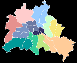 Berliner
Districts - "Bezirke" Berliner
Districts - "Bezirke"
In 2000 the Berlin Senate passed Redistricting Laws which have
reduced the number of self-governing city districts from 23 to
12. Although this measure to some extent threatened individual
districts with a loss of identity, it was welcomed by the majority
as a cost saving for a financially strapped Berlin.
Click on the map to receive a
larger view.
Return to top
Berlin City Center(s)
Although Berlin was reunited after the Fall of the Berlin Wall
in 1989, the city is still in the process of growing together.
Besides the two former city centers in the East and West, many
new centers are sprouting up in between, including Potsdamer Platz
and the new Government Quarter along the "no man's land" where
the Wall used to be. Click on the map to receive a larger view.
Return to top
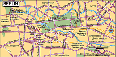
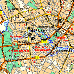 City
Center East - Mitte City
Center East - Mitte
The historical city center of Berlin is located in the district
Mitte. Here you will find the famous bouvelard "Unter den
Linden" and the beautiful square "Gendarmenmarkt".
Both of which shouldn't be missed.
Click on the map to receive a
larger view.
Return to top
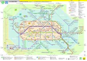 Public
Transportation Public
Transportation
Underground trains - "U-Bahn" and City or Surface - "S-Bahn"
Return to top
Historical Maps
From United States - State Department Archives.
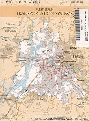 Transportation
Systems Transportation
Systems
Return to top
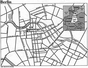 East
Berlin and the former German Democratic Republic (GDR) East
Berlin and the former German Democratic Republic (GDR)
Return to top
Want to know what the weather is like in Berlin? Go to Weather.
© 2002-2003 Berlin Travel Service - A1 Design All rights reserved.
|